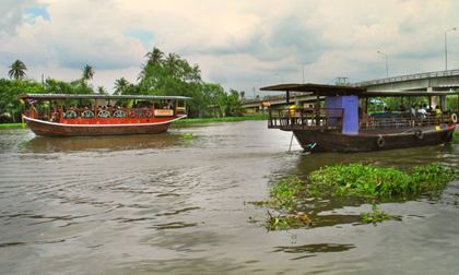
Tourist boats on the Tha Chin near Nakhon Chaisi
Wat Khok Kham
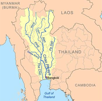
The Tha Chin river is a distributary of the Chao Phraya river, Thailand. It splits near the town Chainat and then flows westerly from the Chao Phraya through the central plain, until it mouths into the Gulf of Thailand at the town Samut Sakhon.
The Tha Chin river has many regional names. After it splits from Chao Phraya river at Chainat, it's called Makham Thao River; while passing
Suphan Buri it is the Suphan River; while passing
Nakhon Pathom it becomes the Nakhon Chai Si river. Only near its mouth at Samut Sakhon it becomes the Tha Chin River, named after the old name of Samut Sakhon. However, for purposes of discussing the river in its entirety, the name Tha Chin is the conventional choice in most scientific documents.
The Tha Chin drains a total area of 13,681 square kilometers (5,282 square miles). [1] The Tha Chin Basin is part of the Chao Phraya Watershed.
|